South Rim Trail – Lake Tahoe Hiking Trails
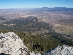
Passing through two states, six counties, one state park, and three National Forests, Tahoe Rim Trail is one of the world’s premier trails. Along the south rim you can see several views of Carson Valley and a few glimpses of Lake Tahoe through the thick forest. The south rim is a moderate to strenuous hike and ascends to 3 separate peaks. The first of these is Duane Bliss Peak, accessible via an easy bushwhack and about 3 miles to the summit from the beginning of the Rim Trail. Visitors are few, as there is not a dedicated trail to its summit, but despite this, it is a beautiful day hike. It can be summited in 2.5 to 3 hours, and views are fantastic. Lake Tahoe stretches out below in all its wonder; Snow Valley Peak, Mount Rose, Relay Peak, and Mount Houghton rise in the north; Genoa Peak and South Camp Peak dominate the south; and there are outstanding views of Mt. Tallac and Dick’s Peak to the west. East is the valley below and the Pine Nut Mountains of Nevada looming behind that. The best time to hike Duane Bliss Peak is around late May to early June after the snow has melted but before it becomes too hot or overgrown.
Up to the top of South Camp Peak is a bit more technical – the trail winds through a combination of steep climbs, switchbacks, and rocky steps. About two miles along the 3 mile trail are views of Lake Tahoe below. After climbing out of this area you make it to the intersection with the road to Genoa Peak, and if you continue up South Camp Peak, the trail climbs its way to the summit slowly. Soon before the top there is a section of loose-shale and rocks, and the peak offers a 180 degree view of the Lake Tahoe Basin and the snow-capped mountains in the distance.
Genoa Peak is about 4 miles to the top of the arduous 9,150 foot summit. Most of the hike is on a Jeep road, which makes the trail wide and the terrain easy. Not counting the few dips and rises, it’s about 1,450 vertical feet up. If you take one detour, you’ll come across three crosses in a big cairn. This is the site of an airplane crash, and some wreckage remains around the cairn. The last road to the peak is very rocky and steep and requires some effort. If you make it all the way up, magnificent views await of Jacks Valley, Carson City, Minden, and Gardnerville on one side and Lake Tahoe on the other.
The South Rim Trail also makes for a difficult and fun mountain biking or horseback riding trail. You can go to Bike Hint to get any biking gear you need. If you’re backpacking and continue on, it’s 12 miles one way to Kingsbury Grade (Highway 207). Parking for the beginning of the trail is available at the Spooner Summit Rest Area located along Highway 50. The trail begins behind the Nevada Department of Transportation building.


Leave a Reply