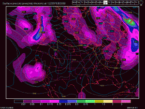
Ok. I know I was pessimistic in the last post for Lake Tahoe weather but things may be changing for the better ( if you like weather) a bit sooner than even the models were indicating yesterday. For some reason the ensemble weather models are all showing some sort of low dropping out of the Gulf of Alaska and forming a cutoff low off the California coast early to mid next week. How much precipitation this brings to the Lake Tahoe region remains to be seen but at least the models are now in complete disarray over what will be happening and NOT holding the persistent north Pacific high in place for much longer. This is good news if you want to see a major pattern shift! I know many of you will be traveling to Lake Tahoe this month and especially over the big Presidents weekend so I will try and up-date this post on a daily level from here on out through late March or early April. It does appear and this is tough 14 days out that it may be an active pattern during the Presidents weekend. Make sure you stay tuned to weather before driving up to your South Lake Tahoe Vacation Rental.
Here is link to the NWS forecast for 01-27-09:
Map for Mid-Week Early February

Lake Tahoe Weather Map


Leave a Reply